


Impossibly blue water at the end of a punishing gravel road — and why this “hidden gem” isn’t so quiet anymore.
Reynolds Ponds gets called a hidden gem of Manitoba, and the water really is so blue it looks fake in photos. But I’ll be honest up front: in recent years so many people have found out about this place that the peace and quiet has thinned out. We’ve been twice — and both times it was very busy. If you’re coming for solitude, factor that in. The full guide to the place — its history, depth and safety — is in our Reynolds Ponds place guide; this is about how it went for us.
The road that tests your suspension
The first thing to know: the ponds sit at the end of a gravel road beaten into one long washboard. Comfortable it is not — it rattles you hard enough that conversation in the car turns to vibrato. And that’s not even the hard part. It’s about 77–80 km and roughly an hour from Winnipeg; if you’re not rushing, you can make a quick stop at the Centre of Canada monument on the Trans-Canada along the way.
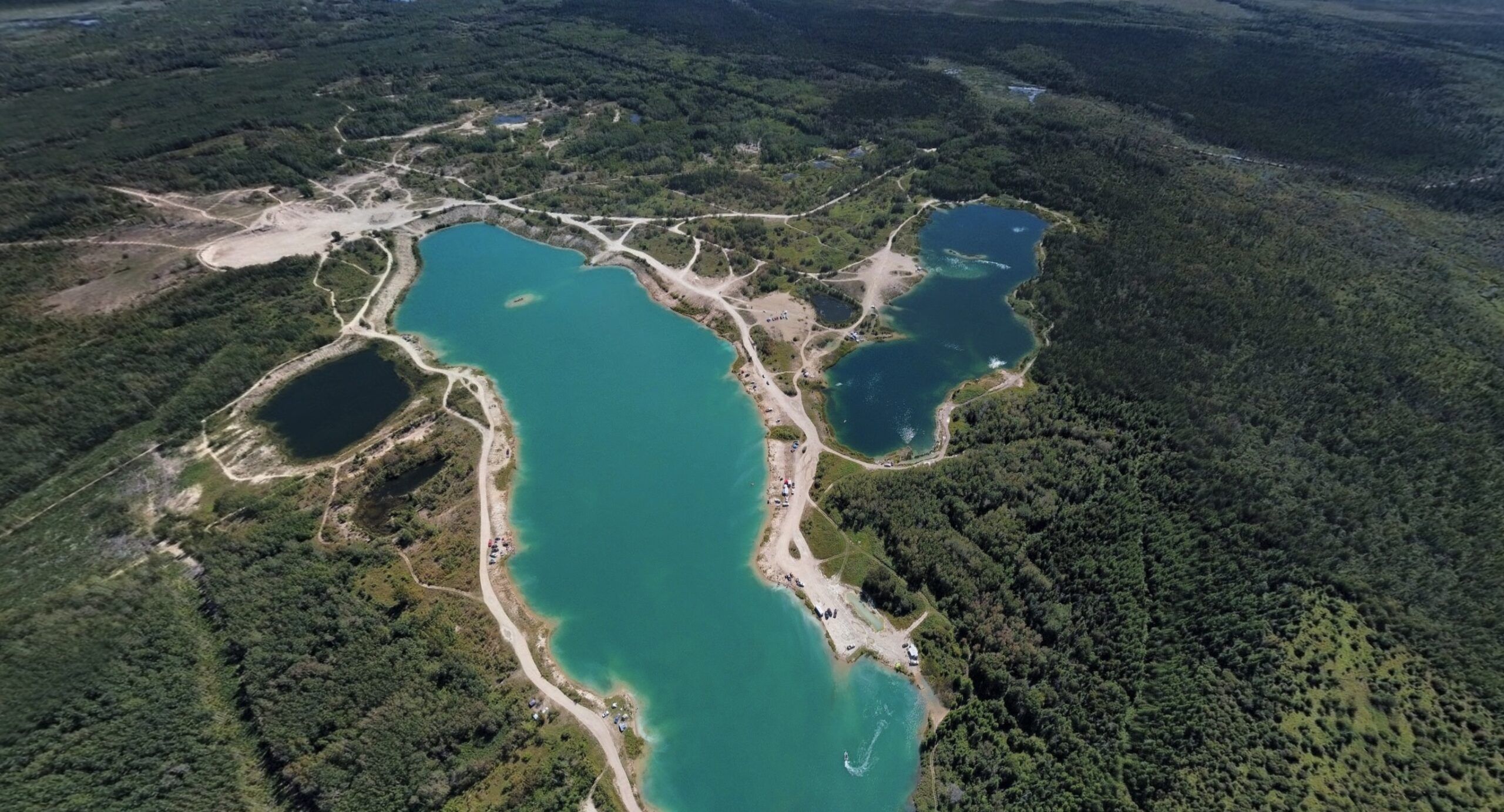
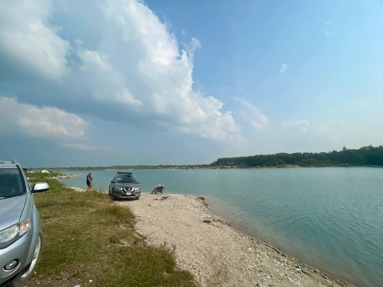
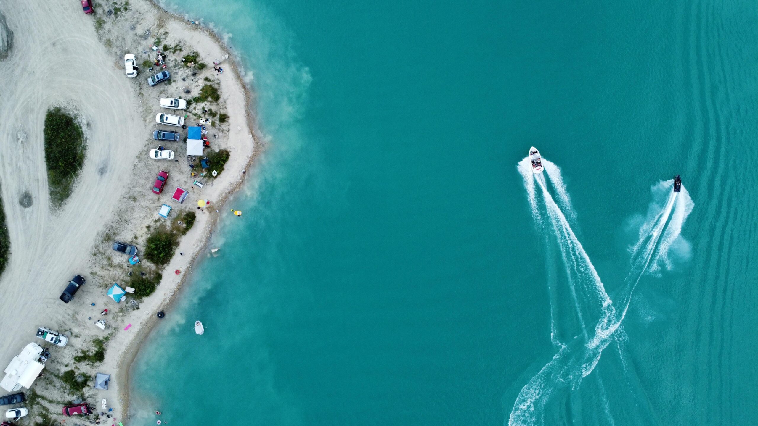
We first came out here in 2024 with friends. A quick note on orientation so the rest makes sense: as you approach the water from the access road, the left leads to the easier road with the Sea-Doo launches (which is exactly why it’s crowded), while the right is that rough, steep branch. When we arrived it was genuinely busy: the entire left bank was lined with cars and tents. So we decided to cross to the right bank.
The right bank and its brutal descent
The right bank is less crowded — and not by accident: the road down to it is very steep, with washed-out sections and deep cracks in the ground. We had an all-wheel-drive Outlander back then, and even with it the descent, and especially the climb back up, was no joke. The big changes in the terrain don’t let you drop down — or get back out — calmly.
I’ll say this as someone who loves his cars and looks after them: all-wheel drive alone isn’t enough here. You want decent clearance and good tires too, and after rain I wouldn’t attempt it at all. I’ve heard from friends that some people have made it in sedans, but I wouldn’t risk it — it’s far too easy to leave a bumper behind, or worse. Why the municipality, or the regulars who drive out here constantly, don’t grade the road even a little is a mystery to me.
The water that drops your jaw — and the Sea-Doos
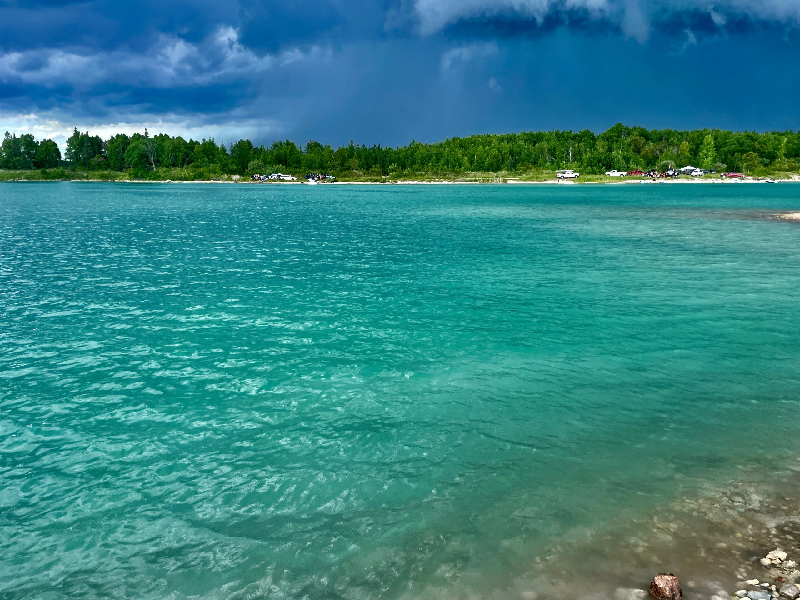
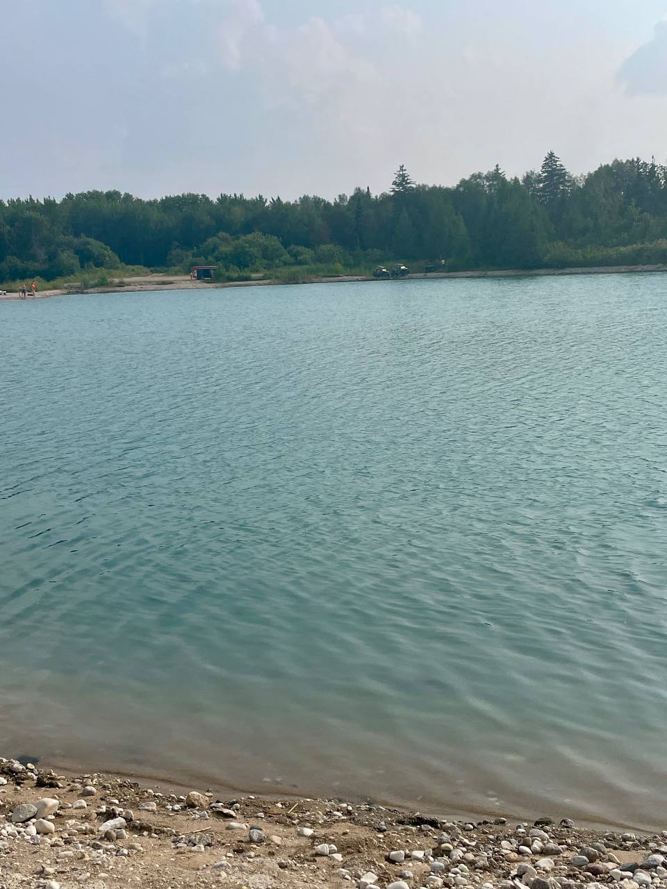
Then you get what you came for: the water. Impossibly blue, deep, framed by those quarry walls. Even on a hot day it stays cool — this is a flooded quarry, so it’s deep and fed by springs. That’s exactly why you have to be extremely careful getting in, especially with kids: the shoreline is steep, and just a couple of metres from the edge it can already be very deep.
Now and then the quiet gets broken by a swarm of Sea-Doos tearing across the water. If you plan to launch your own craft, that’s done on the left bank, where there’s space for it.
The second time, 2025: new car, same road
We came back in 2025 in a new Volkswagen, also all-wheel drive. Since the car was new, we tried to find a better way down to the right bank — no luck. There’s almost no signal out there, so the map wouldn’t load properly, and the maze of informal tracks only confused things. In the end we went back to the old road, which a year on definitely hadn’t improved. And it was just as busy.
Being honest about the crowds and the litter
I don’t want to paint a picture that isn’t there. It’s a beautiful place, but its popularity has a downside: people often report litter and very loud parties running till morning, and we saw the crowds for ourselves. If you go — please, take everything out with you. The rule is simple: pack in, pack out. A place like this only holds up on how carefully the people who visit treat it.
We’ll be back
We didn’t take many photos back then — we weren’t thinking about building a site yet. So here’s a promise: in 2026 we plan to come out again and add fresh shots. In the meantime, all the practical detail — vehicle, safety, when to go — is in the Reynolds Ponds guide.
| Detail | Info |
|---|---|
| From | Winnipeg |
| To | Reynolds Ponds, RM of Reynolds, MB |
| Coordinates | 49.712910, -96.258628 |
| Road | Washboard gravel; steep, washed-out descent to the right bank |
| Vehicle | AWD/4×4 + clearance + good tires; skip it after rain |
| Water | Flooded quarry: deep, cool, steep drop-offs — careful with kids |
| Crowds | Often very busy; litter and loud parties are a real issue |
| Season | Summer |
Read next: the full Reynolds Ponds guide, and nearby in southeastern Manitoba, Seven Sisters and Whitemouth Falls and the Pinawa bridge and channel.