

Before it became Manitoba’s bluest swimming hole, Reynolds Ponds was a working quarry.
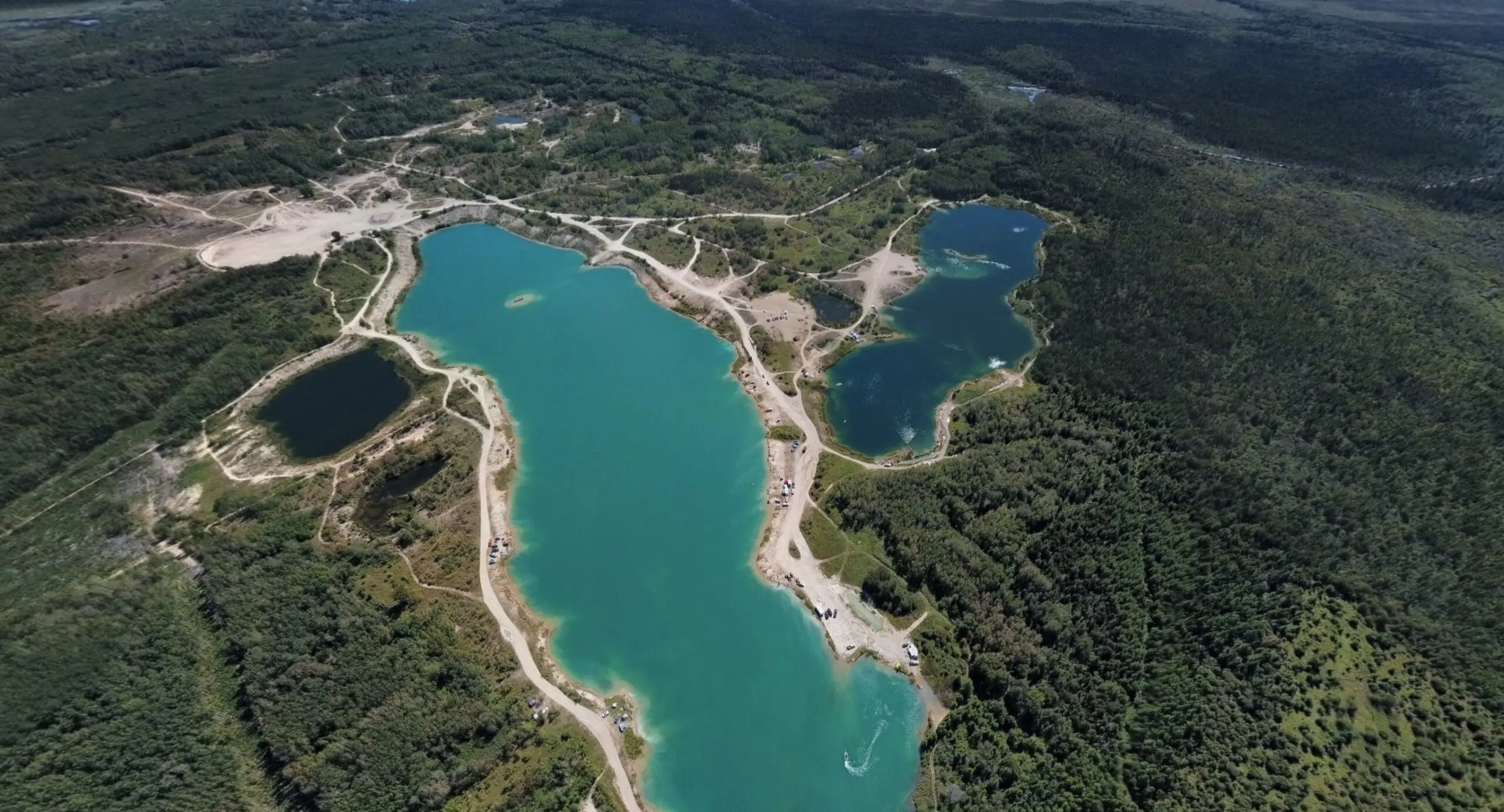
The first time you see that turquoise water, it looks like a natural lake someone stumbled on in the bush. It’s actually the opposite: industry created this, and nature only finished the job. We’ve already written about our Reynolds Ponds day trip and put together a Reynolds Ponds guide to the road, vehicle and safety; this is its backstory.
A quarry left to the water
Reynolds Ponds didn’t form on their own: the workings were dug out by Supercrete Incorporated under a quarry lease. When the work stopped, the deep pits slowly filled with water — groundwater and springs — and where the quarry had been, a cluster of ponds appeared. That’s exactly why the water looks so unusual: it’s deep and clear rather than shallow and warm like a natural pond, which is what gives it that turquoise-blue glow.
Because of that industrial past, locals still use two names. Many distinguish the “Lafarge pits” — the first entrance, marked by large concrete blocks — from “Reynolds Ponds” proper, the next turn along. It isn’t a mistake: historically these are neighbouring workings, and each has its own character, right down to which fish live where.
Nine ponds with bird names
Today the water is divided into nine numbered ponds, each with a bird name — Robin, Bluejay, Whiskeyjack, Woodpeckers, Nuthatch, Meadowlark, Oriole, Grosbeak, Goldfinch. That isn’t local folklore but the official scheme the province uses to track the waterbodies. It’s also how the stocking is managed: Manitoba releases trout here each year — rainbow, brown and brook — to keep a trophy fishery going.
Trout, bass, and what shouldn’t be here
Here’s the twist. Reynolds Ponds was meant to be a trout spot, but a few years ago illegal stocking changed the ecosystem. Largemouth bass were first recorded here in the spring of 2011, and rock bass and bluegill followed. The problem is that bass are predators that happily eat the stocked trout, while rock bass and bluegill compete with them for food. In some ponds the trout have effectively stopped reproducing, and biologists warn that if bass spread further, Reynolds Ponds could lose its status as a trout destination altogether. So when anglers ask people not to stock the ponds themselves, it isn’t red tape — it’s an attempt to save the thing that makes the place special.
How a quiet quarry got loud
For a long time this was a spot for insiders — anglers and locals. But deep blue water is too photogenic to stay secret: drones, social media and videos did their work, and thousands of people learned about Reynolds Ponds. With the popularity came the problems we wrote about honestly in our trip piece: crowds, litter, loud parties. It’s the same arc as many a “hidden gem” — a place loved to the point where it stops being what people came for.
So the ending of this story is still being written, and it depends on the people who show up. The quarry turned itself into a lake; whether it stays beautiful is up to us.
Read next: our day at Reynolds Ponds and the Reynolds Ponds guide to the road, vehicle and safety. Primary source for the facts: Manitoba’s Reynolds Ponds fisheries report.